Travel Across the Great Alaskan Tundra
Posted in Alaska, Scenery, Travel | By Guest Author | Tags: Alaska, Scenery, Travel, Wildlife
By Guest Author Peggy Bradshaw, Photos by George Bradshaw
The tundra of Alaska is a stark but beautiful landscape. As the coldest of all the biomes, tree growth is hindered by low temperatures and a short growing season. Tundra also contains permafrost, which means that the soil is permanently frozen and can be from 10-35 inches deep, making it impossible for trees to grow.
Because the soil is frozen, moisture cannot soak into the ground, thus forming the lakes and pools that are so prevalent across the Alaskan North Slope. The permafrost lies only inches beneath the surface of the Coastal Plain, thus creating a bizarre landscape of wetlands and ice-wedge polygons.

Caribou watering at the Sagavanirktok River
The Dalton Highway runs north and south across the tundra and into the mountain ranges and gives marvelous views of scenery like no other in the world. There are Wayside Stations and Overlooks along the highway and plenty of opportunity to stop to take photos, watch wildlife, or just walk around to soak up the cool air.
The tundra is home to the world’s largest herd of caribou and they have seasonal migration. The herds always have the right-of-way as they cross the roads. You can also spot wolves, wolverine, grizzly bear, red fox, and musk ox. Hunting over the open terrain along the highway and river are many birds of prey. While crossing the Brooks Range you can spot moose and wolves, and make sure you scan the skies for golden eagles. The Arctic National Wildlife Refuse borders the BLM Utility Corridor to the east and extends across the Brooks Range and the North Slope to Canada. It offers extraordinary wilderness, recreation and wildlife values.
This far north in Alaska, the sun never sets between May 10 and August 2, and never rises between November 18 and January 23.

Arctic Circle sign - yes, it is that cold!
The Arctic Circle crosses the Dalton Highway at MP 115. It is a must stop for photos and to gather in front of the sign that marks the spot. At this spot the sun stays above the horizon for one full day on summer solstice (June 21) and below the horizon for one full day on winter solstice (December 21).

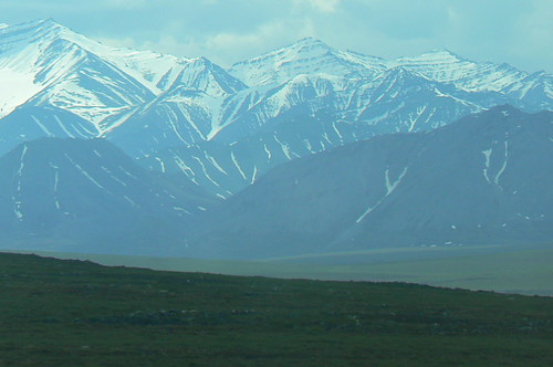
Brooks Range, eerily beautiful
Gobblers Knob at MP 132 offers an excellent view of the Brooks Range to the north. The farthest north spruce, located at MP 235, was approximately 273 years old when it was killed by a vandal in 2004. You leave the tundra and cross the Continental Divide at Atigun Pass (elev. 4,739).
The tundra is a fascinating place to visit and full of wildlife and interesting scenes. State statute prohibits off-road vehicles within 5 miles either side of the highway from the Yukon River to the Arctic Ocean to protect the natural resources.
